
This page features college GIS course highlights (IU GEOG-G 338: Geographic Information Science). The Fall 2022 course was taught by Dr. Erin Argyilan and used the textbook Getting to Know ArcGIS Pro 2.8 Fourth Edition.
Course Exercises
Self-Guided Studies
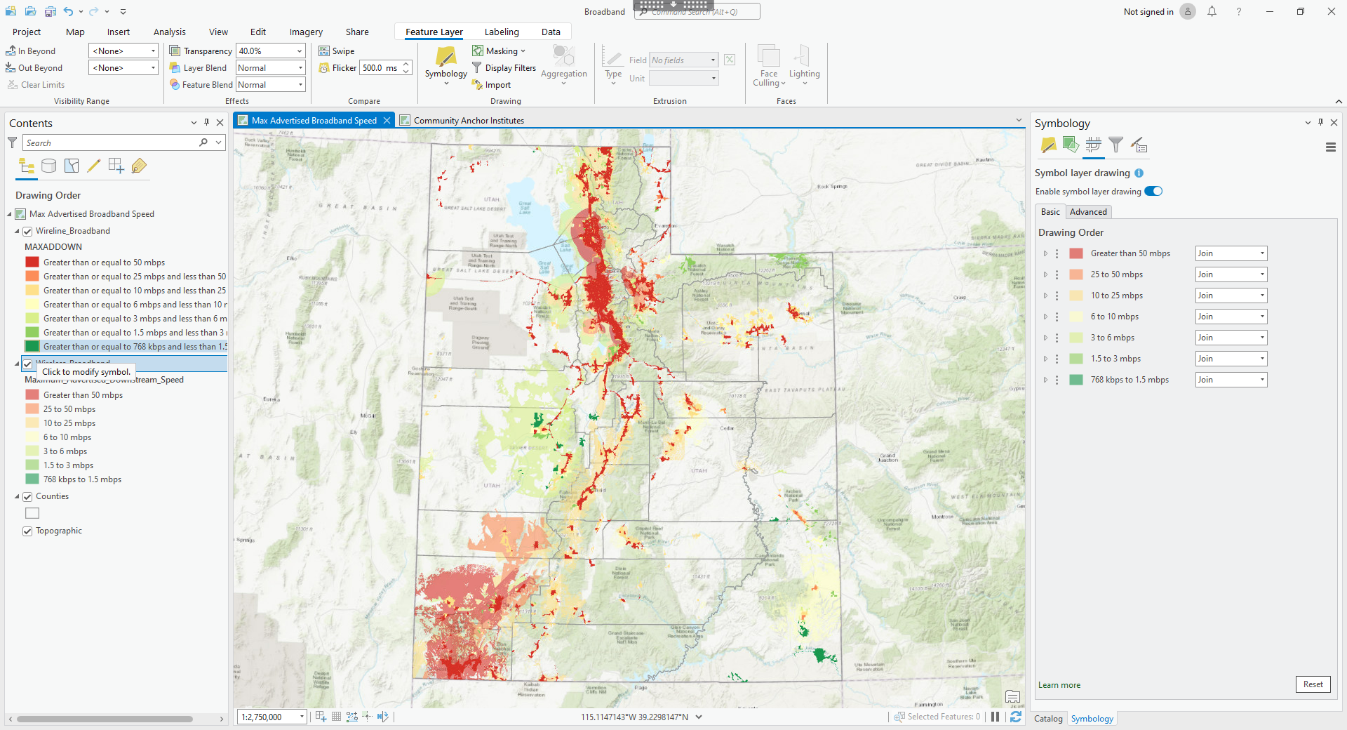
Exercises > Broadband Network Analysis
(Full-size image opens in new tab)
After mapping broadband networks and public access points, results were exported as pdf brochures.
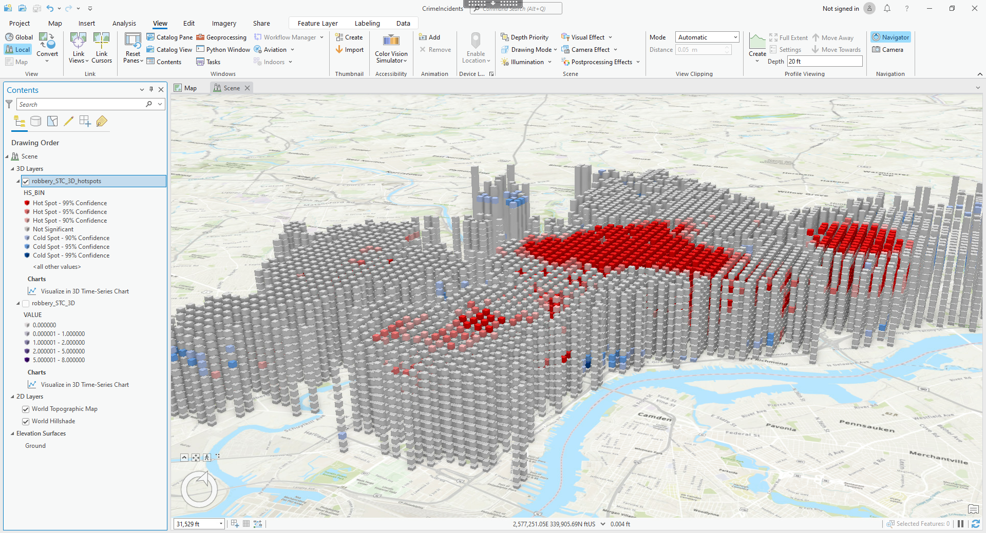
Exercises > Crime Hotspots 3D
(Full-size image opens in new tab)
Annual crime was mapped by categories in a visualized 3D space that combined month with location.
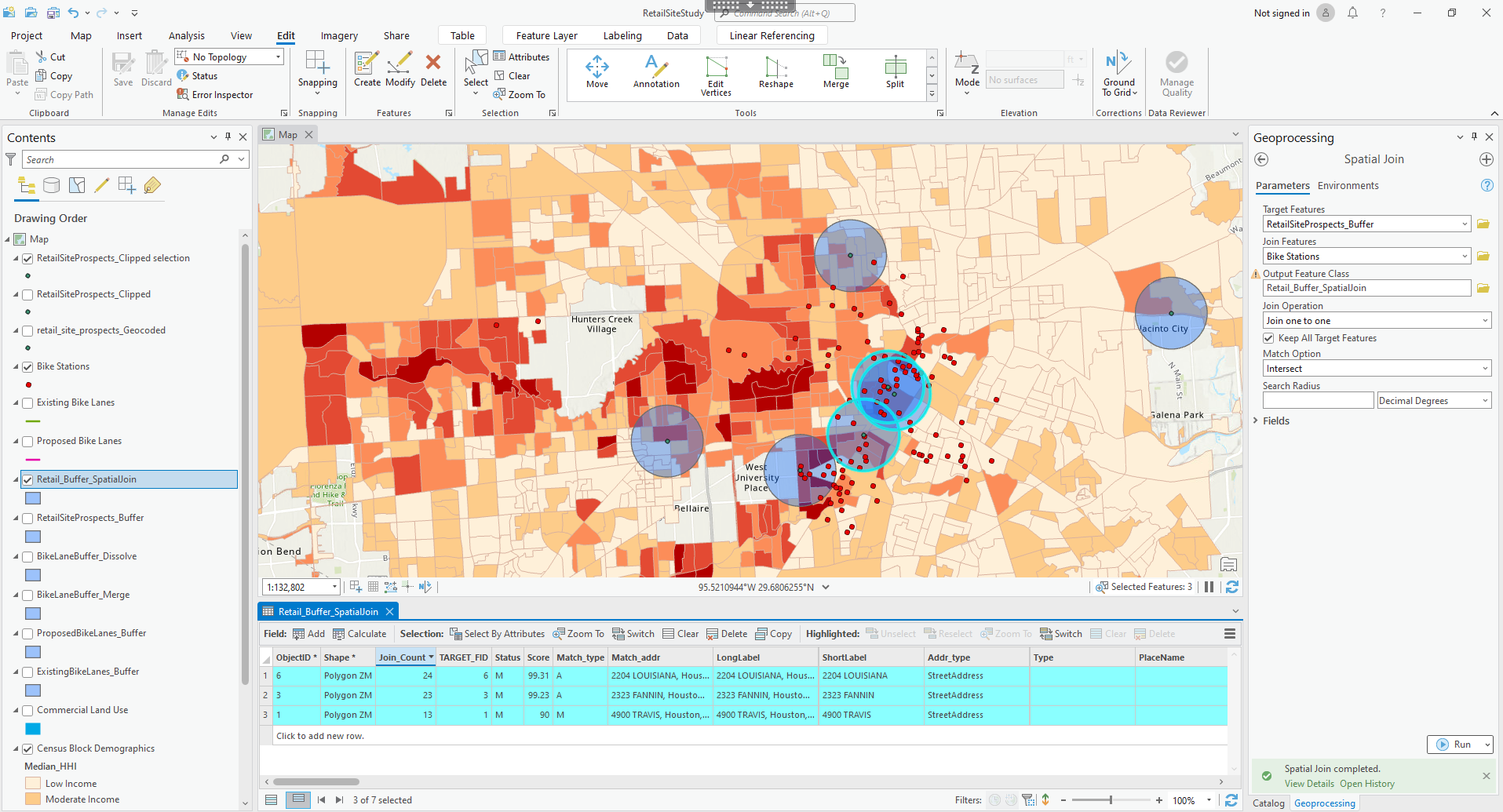
Exercises > Retail Site Prospects
(Full-size image opens in new tab)
The site for a new bicycle shop was chosen by neighborhood income, cost per square foot, and trail proximity.
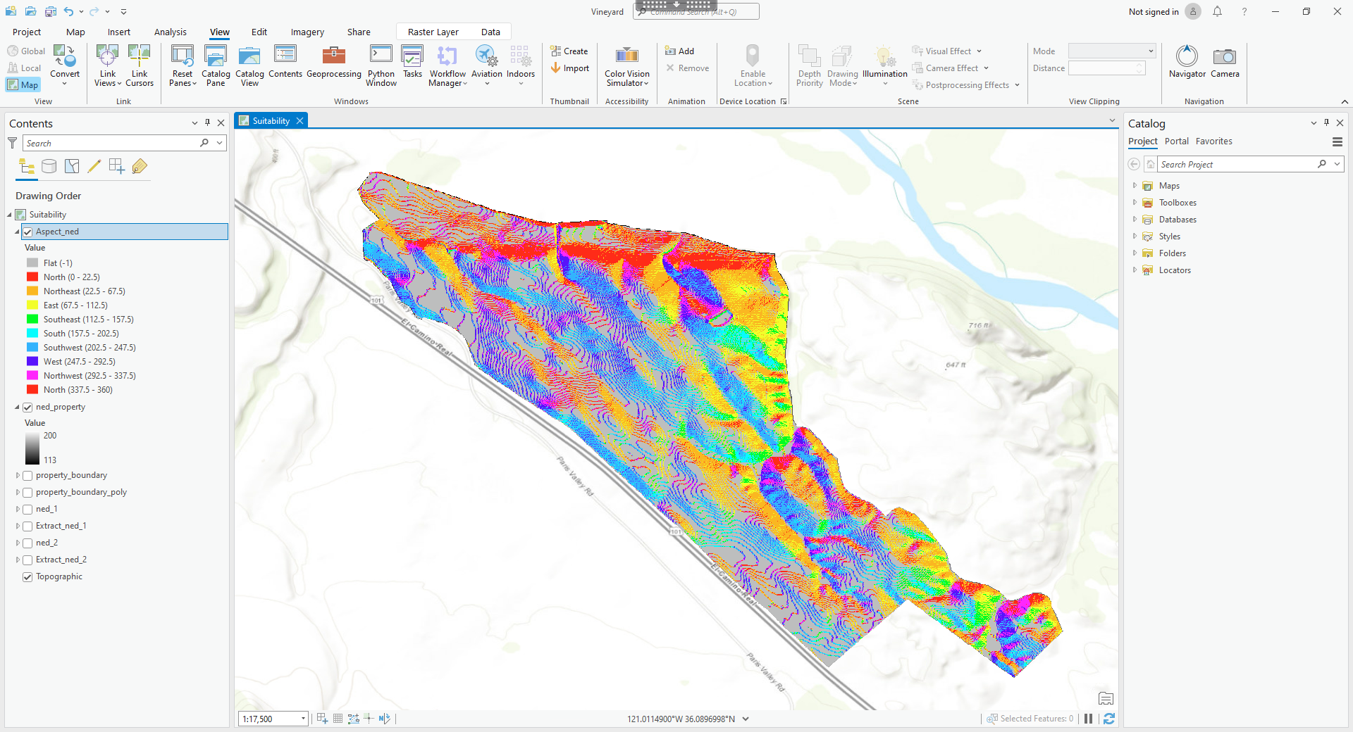
Exercises > Vineyard Plot Suitability
(Full-size image opens in new tab)
The best plot for planting grapes was identified based on slope, shade, and soil analysis.
Studies > Residential Leaking Tanks
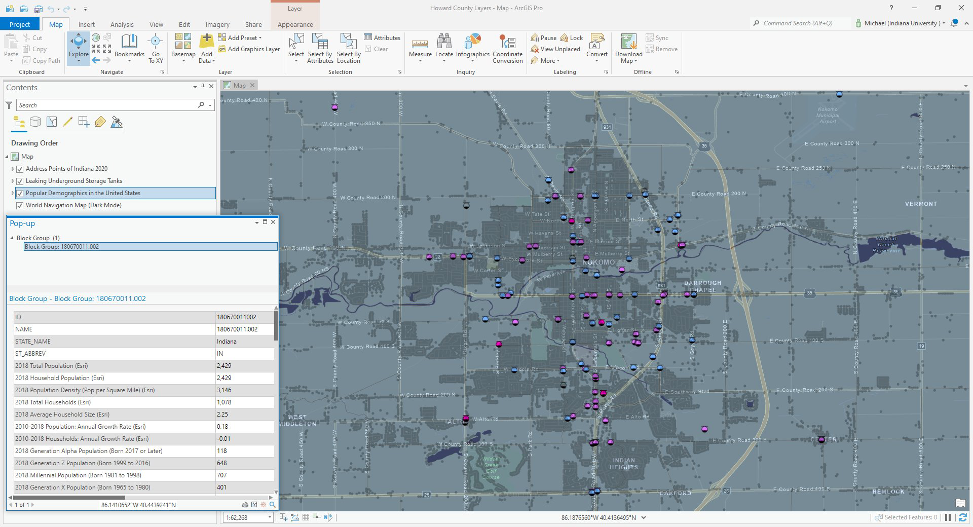
(Full-size image opens in new tab)
Leaking underground storage tanks are shown in residential clusters with census data.
Studies > Traffic Incidents Intersection
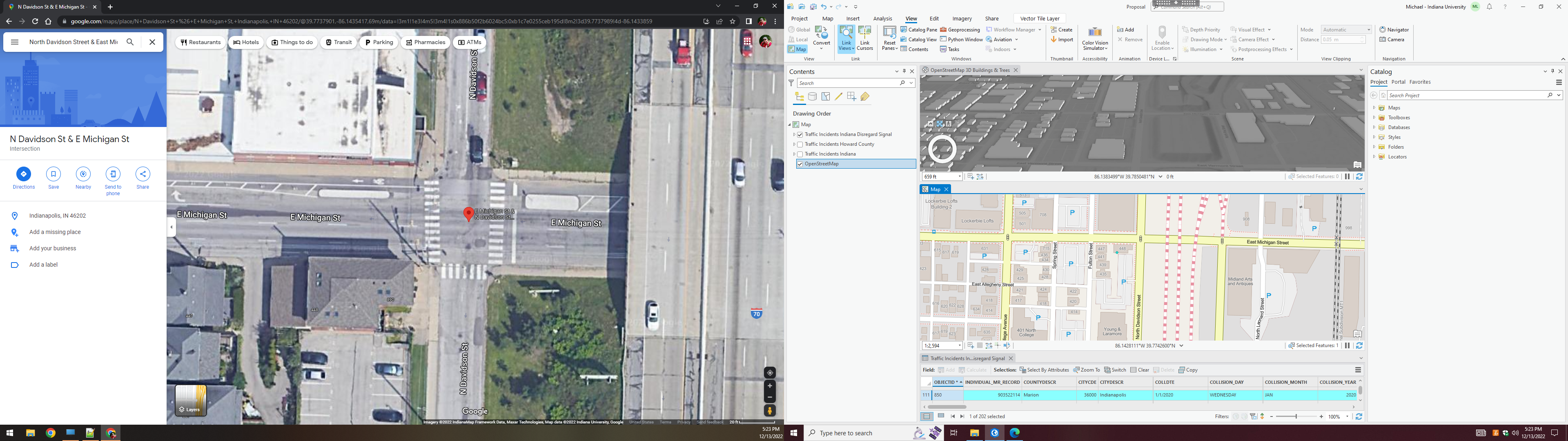
(Full-size image opens in new tab)
ARIES crash data identified dangerous intersections, shown here in three views on dual monitors.
Studies > White River Floodplain
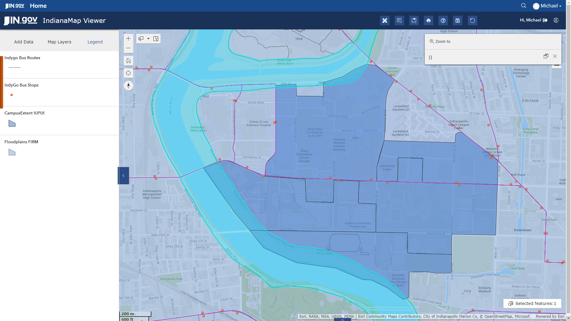
(Full-size image opens in new tab)
IndianaMap analysis identified the bus stops and campus roadways most prone to flooding.